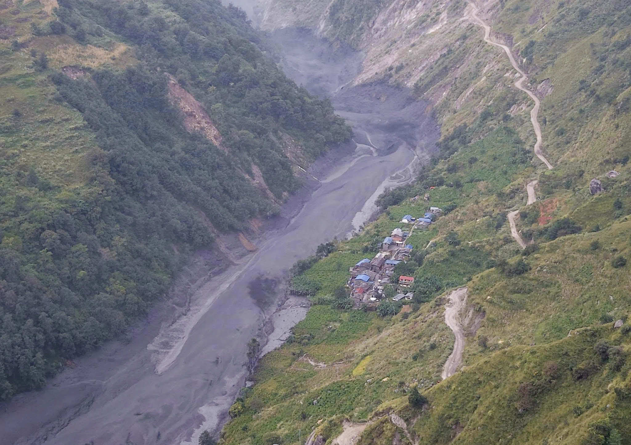
According to the study report, the avalanche occurred at around 4:20 am on October 11 in the upper reaches of Ungdilung Khola in Chumanubri Rural Municipality-6, Gorkha, between Chamar Mountain and Syerangi Mountain.
The avalanche struck at an altitude of approximately 6,000 metres, triggering a major landslide that carried ice and debris from a glacier located at around 5,500 metres, the report said.
The study identified relatively weak rock formations in the region’s Tethys Himalayas as a possible factor behind the landslide. It also noted that smaller landslides occurred in the area both before and after the main event.
A mixture of snow, water and debris then flowed southward along Ungdilung Khola, affecting areas extending approximately 300 metres along both banks of the stream.
The report further states that a large volume of debris accumulated at an altitude of around 2,000 metres, where Ungdilung Khola meets Syar Khola at a narrow confluence. The debris repeatedly blocked and released the flow of Syar Khola, potentially contributing to sudden surges of water downstream.
The findings are preliminary, and further investigation may be needed to establish the full sequence of events that led to the flood.


